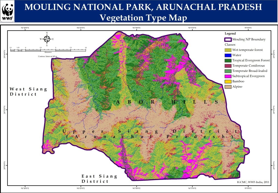
Vegetation
The altitudinal zonation have treeline in the lower reaches and seasonal snowline in the higher reaches comprising of Ganging Mouling peak (3064 MSL), Marang Mouling peak (2940 MSL) and Sibum Mouling peak (2634 MSL).
Forest Types & Distribution
Wet Temperate Forest
Upper reaches with high rainfall and moderate temperatures
Temperate Coniferous Forest
Pine and conifer dominated forests at mid-elevations
Temperate Broadleaved Forest
Deciduous and evergreen broadleaf species
Tropical Evergreen Forest
Lower reaches with dense evergreen vegetation
Sub-Tropical Evergreen Forests
Transition zone between tropical and temperate forests
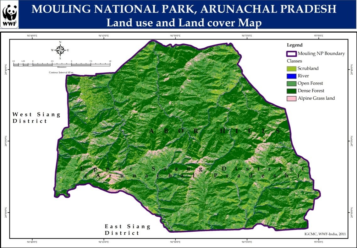
Land Use / Land Cover
250.62
Dense Forest
sq. km
107.91
Open Forest
sq. km
78.89
Scrubland
sq. km
40.47
Alpine Grassland
sq. km
5.11
River
sq. km
Total Area: 483.00 sq. km
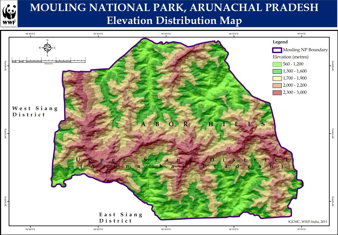
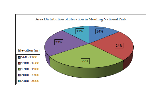
Altitudinal Variation
The altitudinal zonation has treeline in the lower reaches and seasonal snowline in the higher reaches comprising of following peaks:
Ganging Mouling Peak
3,064 MSLMarang Mouling Peak
2,940 MSLSibum (Takek) Mouling Peak
2,634 MSLRepiom Peak
2,332 MSL
Altitude Range: 500 MSL to 3,064 MSL